
Point Cloud Studio by SAS Site Audits | Scan to BIM & Digital Twins
We Capture Reality
Verified existing conditions for architects & commercial designers
Design decisions are only as good as the data behind them. Point Cloud Studio gives design professionals a verified digital record of any site before design begins, so scope is clear, drawings are trusted and no site re-measures are required. Verified Data, Better Design
Business Partners
Years Experience
Digital Twins
An immersive, measurable 3D replica of your site — walk the space from your desk, anytime.
Scan to BIM
Point cloud data converted to editable Revit models and 2D AutoCAD drawings, design ready.
Verified Measurements
Survey-grade site data at 99% accuracy — one scan replaces repeat site visits.
Site Reports & Marked Up Plans
Photographic reporting & marked-up existing plans for projects that need the traditional approach.
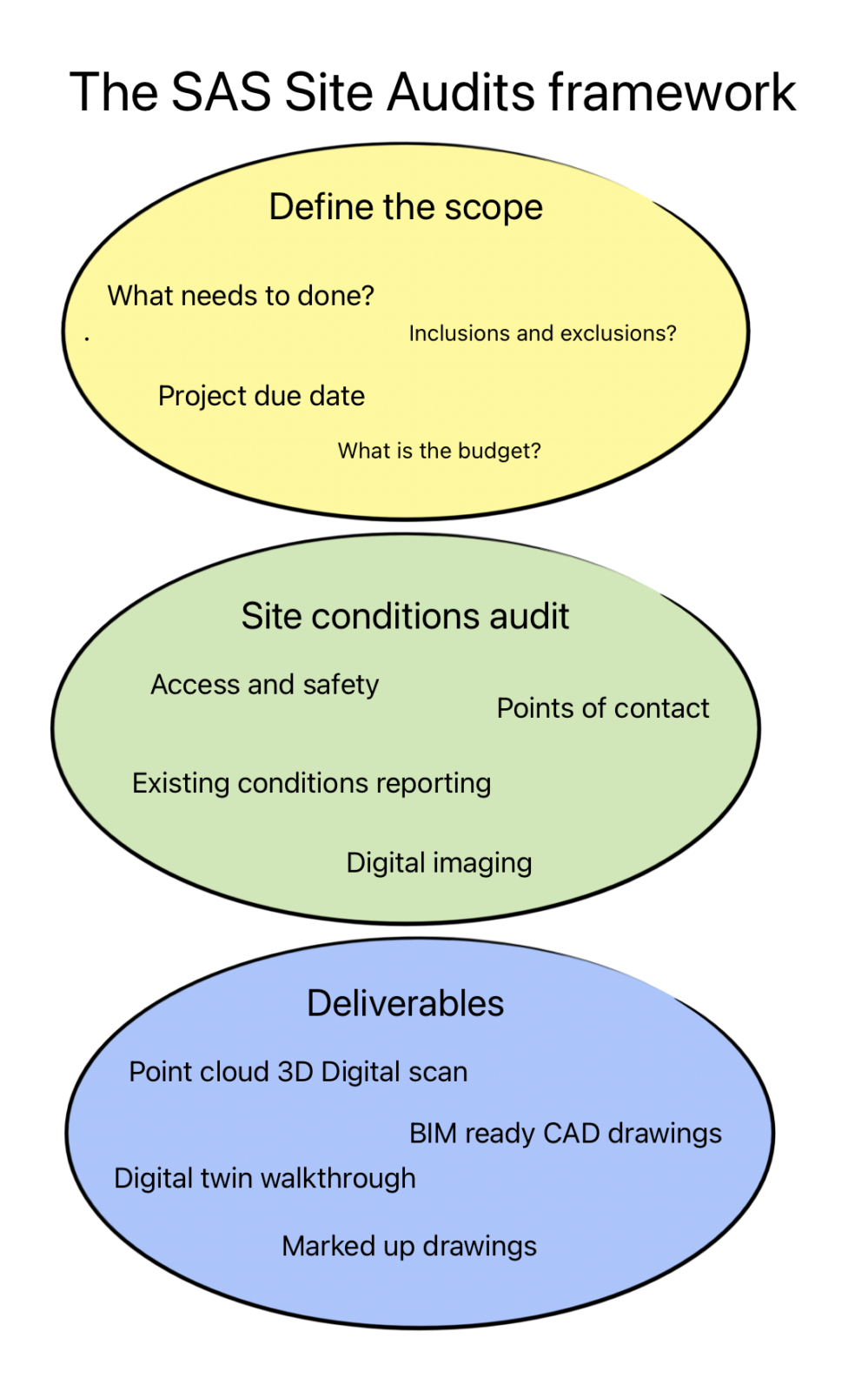
Every project starts with a short scope conversation — what the project involves, what deliverables you need, and exactly what one scan will capture. No cost, no obligation.
Our Methodology
From Site to Studio in Three Steps
Confirm the Scope
We define what’s included, what’s excluded, and which deliverables your project needs.
Capture the Site
One visit. LiDAR scanning and 4K imagery record the full existing conditions — access, structure, services and finishes.
Deliver Verified Data
Digital twin, point cloud, Revit and AutoCAD files — delivered in days, ready to design on.
3D Scanning Tech
Survey-Grade Capture, One Site Visit
Our capture process combines LiDAR scanning with 360° 4K photography to record every measurable surface of a site — indoors and out — in a single visit. Captured on Matterport Pro3 hardware and processed in-studio, the result is a point cloud accurate to 99%: the verified foundation for digital twins, as-built drawings and BIM models. No return trips. No guesswork. No surprises during design.
What you get
Order of Options
Digital Twin
Digital Twin
- An immersive, measurable 3D replica of your site — walk the space from your desk, anytime.
- Collaborate with your client and contractors
- Shareable link
Scan to CAD/BIM
Scan to CAD/BIM
- 360-degree digital scan using Matterport Pro 3 LiDAR scanner
- Digital Twin digital photographic walkthrough
- Still images and short videos
Scan to CAD/BIM
Scan to CAD/BIM
- Point cloud data converted to editable 3D Revit models and 2D AutoCAD drawings, design ready.
- E57 point cloud file for Cad conversion
- Drawings to LOD 300
Site Reports & Marked-Up Plans
Site Reports & Marked-Up Plans
- Traditional site audit method – laser tape, measure tape, measuring wheel
- Photo reference plan and full JPEG photo set
- Marked up PDF floor plans and elevations
Trusted Partners
Trusted by Leading Retailers & Design Professionals